 This is another one of those walks ideal for those who want to experience a true mountain and feel that high mountain experience but without too much effort. Starting at a lofty three hundred and ninety three metres above sea level this is a fairly easy to moderate walk taking you to the top of a proper mountain with stunning views over the south of the Lake District.
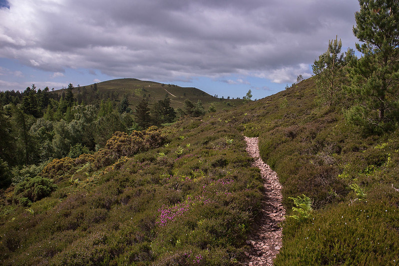
You can make this walk an easy walk too by cutting it short and simply walking out to the tarn if you don't feel like climbing the mountain. The walk starts high on the Wrynose Pass by the Three Shire Stone and takes a straight forward but often boggy path out to Red Tarn where you can then take a fairly obvious and steep path up to the top of Pike of Blisco for those incredible views and then back down returning the same way. Simple yet satisfying walk all year round but do be careful of the steep Wrynose Pass road in the winter as driving conditions can be treacherous. An ideal eye opener for first timers. Route Directions This walk starts from the top of the Wrynose pass by the Three Shire Stone at grid ref NY 277 027. The Wrynose Pass is one of the highest and steepest road passes in England topping out at 393m above sea level which makes it an ideal starting point for an easier ascent of several mountains accessible from here. It also makes it pretty treacherous in winter conditions so take care. To find the pass take the A593 road between Coniston and Ambleside and just a mile south and uphill from Skelwith Bridge head off down the road sign posted for Elterwater and Little Langdale. After reaching the bottom of that valley and crossing the river take the steep road off to the left sign posted for Little Langdale. You should pass the Three Shire Inn on your right then through the beautiful Little Langdale village and eventually see the picturesque Little Langdale Tarn on your left. After crossing a cattle grid keep to the road on the left sign posted to Wrynose and ignore the road to the right to Langdale. Drive slowly and carefully through the idyllically located Fell Foot Farm, a 17th century Grade II listed National Trust property. The road now ascends the steep gradient and eventually reaches the summit where a dozen or so road side parking places can be found. The Three Shire Stone is an impressive triangular limestone pillar that marks the position where until 1974 the old counties of Lancashire, Cumberland and Westmorland once met. The stone is carved with the name Lancashire on one side and W.F. 1816 on the other which is the initials of the Furness roadmaster William Field for whom the stone was made in 1816. The stone wasn't erected until 1860 and stood the test of time until 1997 when it was damaged by a motor vehicle, it was soon restored by Gordon Greaves of Troutbeck Bridge a year later. There are several other Three Shire Stones in Britain which were used for the same boundary marking purposes. From Three Shire Stone take the path that heads north to Red Tarn. The path crosses a few boggy patches on the first few hundred metres and never really improves that much but is always an obvious path. On your right as you follow the path the crags of Long Scar on Pike of Blisco's south side dominate the view. The path crosses a few streams at an area known on the map labelled as the Duddon Grains, these are the source of the well known River Duddon which makes its way through the Duddon Valley and out to the Duddon Estuary. Looking back now as the path gains height you can see over the Wrynose Pass to the Coniston Fells on the south side of the pass. From left to right you should be able to identify Wetherlam, Swirl How, Great Carrs and Grey Friar. Also visible from this point at the end of the westerly view down the Upper Duddon Valley you may be able to make out the cars struggling up the neighbouring Hardknott Pass and the lonely hill of Harter Fell. Once the path levels out it will then take an easy descent to the eastern side of the beautiful Red Tarn. High above Red Tarn on the other side of the valley is Cold Pike, Pike of Blisco's relatively less trodden neighbour. The scene here in winter is often a cold one as the valley sees little sunshine on a winters day, it being shadowed for most of the day by these two mountains and by the Coniston Fells. The views ahead now will open up for you to get your first glimpse of Crinkle Crags and the mighty Bowfell beyond. Walk to the far north eastern end of the tarn and just as the path turns left heading towards the path crossing the stream there is a rough path heading right off the main path that will take you up a rough ascent to Pike of Blisco. Take this path off to the right and head up the side of Pike of Blisco. You may have spotted some of the local Herdwick Sheep by now, local to the Cumbrian Fells and to many the nicest sheep you are likely to see. The path up Pike of Blisco is quite rough in places but fairly obvious most of the way and its fairly obvious which direction you need as it heads up towards the summit. Once you reach the top you will see that there is actually two summits, the highest of the two summits is the one to the north with a big round stone cairn looking down into the Langdale Valley. A faint path heads up on the left hand side of the summit rocks avoiding the more difficult route on the right. The summit of Pike of Blisco stands at a proud seven hundred and five metres above sea level, just four metres higher than its neighbouring Cold Pike. The mountains name is often surrounded in controversy as it was originally known as Pike o' Blisco and over the years has been anglicised into Pike of Blisco and now appears as such on OS mapping. Alfred Wainwright certainly knew which was his preferred name and said that "the man has no blood in his veins who does not respond eagerly to its fine-sounding, swashbuckling name". He'd most likely not be happy at the Ordnance Survey or myself for referring to it by its now more commonly used anglicised name. From the summit of Pike of Blisco you can do a complete panorama starting with the obvious Cold Pike across Red Tarn turning clock wise you will pass the line of bumps known as Crinkle Crags then their mighty neighbour the pointy Bowfell. Turning clockwise again across the Langdale Valley below you will be in direct view of the Langdale Pikes. Continuing round clockwise in the distance you'll see the mighty ridge of the Helvellyn massif which eventually slopes down to the Fairfield Horseshoe and Ambleside at the top of Windermere. Then of course looking to the south you see the Coniston Fells with the bulk of Wetherlam on the left directly to the south of Pike of Blisco. After experiencing the views from both of Pike of Blisco's two summits descend on a south easterly direction on the same path back down to Red Tarn, this time enjoying the views you couldn't see on your way up. Once back at Red Tarn turn left heading south to south east back down the same path the same way you came, now with Red Tarn on your right. On you return you can now marvel at the Coniston Fells. The path will lead you back to the Three Shire Stone at the Wrynose Pass where care should be taken on your drive back down the steep road. On your way home make sure you head to the Three Shire Inn in Little Langdale for a friendly welcome, cosy surroundings, local real ales and freshly made food. It is a great place in winter with its real fires and a great place in summer to sit out on the tables in awe of the beautiful Little Langdale valley. Of course if you return via Langdale instead there is the Old Dungeon Ghyll or heading home west there are several options around the Duddon Valley and Eskdale.
0 Comments
 This is a moderate walk to the highest point in Cheshire, Shining Tor. The walk starts in the beautiful and easily accessible Goyt Valley just an hour from the suburbs of Greater Manchester. There is a wide variety of landscapes including the reservoirs, woodlands, forestry, farm lands and high peak moorlands. This walk takes in several unusual features including the most popular feature of the walk, the ruins of the old Errwood Hall and its surrounding estate. This vast estate, its varying landscapes and unique buildings were all created and owned by the wealthy Grimshawe Family. They certainly left their mark on this incredible area. There are the unique buildings of Errwood Hall, the Spanish Shrine and the ruins of many others. The surrounding woodlands are enchanting and bursting with the colours of the Yellow Azaleaa and Purple Rhododendron shrubs the Grimshawe's brought back from their many travels. The upper section of the walk involves a long traverse of the Cats Tor and Shining Tor ridge which is typical peat moorland and gives great panoramic views. Route DirectionsThis walk starts from the Erwood Car Park in the Goyt Valley. The car park is situated on the west side of the reservoir at grid reference SK 012 748.
To reach the Goyt Valley turn off the main A5004 Whaley Bridge to Buxton road near Longhill Farm where the Goyt Valley is clearly sign posted down the minor Goyt's Lane road. After descending to the reservoir drive across the dam then turn left on the other side, ignore the first car park, instead head along the road and after a kilometre you will reach the Errwood Car Park. From the car park head head west up the main path which is sign posted to Errwood Hall. The path ascends a field then reaches a gap through a stone wall. Head through the gap on to a track. Turn right and pass a metal anti motorised vehicle gate. The track now heads through the woodlands. After two hundred and fifty metres a stream passes under the track and is then on the left side. After another hundred metres there is a track that switches sharp right and is clearly sign posted to Errwood Hall. Turn right here and head up the track to reach an opening in the woods where you will find the ruins of the old Errwood Hall. Errwood Hall was built in the 1830's by a wealthy and well educated Manchester business man by the name of Samuel Grimshawe. He gave this impressive stone built mansion and surrounding estate to his son as a wedding present. The hall was a happy home to two generations of the Grimshawe Family for over a hundred years. The estates comprised of two thousand acres of land with workers cottages, a private school, woodlands, moorlands, farmlands, farms, a small hamlet, a private colliery and several other small buildings and features. Sadly the hall was demolished in the late 1930's when the Fernilee dam and reservoir were constructed to provide water for the growing industrial town of Stockport. All that remains of the hall now is its stone floors, a few steps and the impressive stone arched window frames of the last remaining wall which luckily for us are all preserved by the Peak District National Park Authority. Head to the northern end of the ruins and turn left, heading west along a path through the woodlands with a stream down to the right. After just over a hundred metres the path descends to the stream and crosses it over a lovely curvy wooden bridge. You will soon reach a crossing of footpaths. Here you need to go straight on to head north to north west on the clearly sign posted footpath to Pym Chair. The path ascends through a field with the valley on the left and a stone walled woodland on the right. After three hundred metres the path passes through a stone wall. Here the Foxlow Edge path ascends to the right. If you want you can choose the higher route here over Foxlow Edge which will also take you to Pym Chair. Continue along the path as it ascends through the valley. After a while the path will pass the ruins of the old Withinleach Farm buildings on the right. Just eighty metres on from the farm ruins you will come across a most bizarre building between the trees. If you chose the higher Foxlow Edge route you may miss out on this unless you turn back before you reach the road. The Grimshawe family built this Spanish Shrine in 1889 in memory of Dolores de bergrin. Miss Dolores was governess to the children at Errwood Hall and teacher at the estates small private school. Sadly she died in her early forties on a visit to Lourdes. The shrine is usually open to the public so you should be able to open the wooden door to reveal its inner delights. The wall of the shrine has a beautiful tiled mosaic. It also has a pulpit, religious items, candles, letters and remembrance items. Continue the ascent of the main path. The Foxlow Edge path will join from the right. You will eventually reach the tarmac minor road known as The Street. Pass through the gate and cross the road to reach a safer footpath on its far side. Turn left and ascend the steep road side path for just under a kilometre until you reach the top of the pass known as Pym Chair. Head back to the other side of the road here and go through the gate to start the ascent of Cats Tor. Looking back as you ascend Cats Tor you should start to see views opening up towards the higher peak areas and out towards Manchester and Cheshire. An eight hundred metre ascent will find you on the top of Cats Tor. From Cats Tor continue the ridge walk along the now paved path for another kilometre to reach the col between Cats Tor and Shining Tor known as The Tors. From The Tors continue heading south along the main paved path to ascend the bulk of Shining Tor. After another kilometre long ascent you will reach the summit of Shining Tor, at 559m above sea level the highest point in the county of Cheshire. A county with a reputation of being completely flat! The summit has a trig point pillar that can be reach by heading through the gate in the stone wall at the summit area. There is also a bench on one side of the stone wall sheltered from the prevailing winds. The summit of Shining Tor is fairly featureless but does have some fantastic views. The most noticeable being the view towards its shapely neighbour Shutlingsloe which often steals the headlines as it is a lovely shaped hill. From the summit head in a south east direction along the path that skirts the head of Shooter's Clough. The path dips down then up again then passes through a gate in the impressive stone wall on the top of the Stake Side ridge. On Stake Side you can, if you have a spare hour or so, turn right and take a detour to the Snake Pass Inn which is now in view. If not heading over to the Inn then turn left and head north to north east down the Stake Side ridge with the impressive stone wall now on your left during the descent. After a kilometre of descent you will reach a gate on your left. Head through the wooden gate and turn left on the path that descends through more impressive and enchanting woodland to Shooter's Clough. After two hundred metres the path switches hard right and turns in to a wider track that continues the descent in to Shooter's Clough. After another three hundred and fifty metres the path switches back left on itself and heads down to the stream at the bottom of the valley. The path crosses the stream over stepping stones. On the other side turn right and follow the path now with the tumbling stream on the right. The path passes man made stone walls and waterways of the old colliery and then reaches a path junction below a knoll. Here below the knoll there are many old ruins and walls, these are mostly the houses of the workers and servants of Errwood Hall. Here head up on to the wooded knoll to find the Grimshawe's family cemetery which is well worth a look. From the cemetery head back to the track and head east along it with the stream down to the right. The track will soon bring you back to where you left it earlier below the old Errwood Hall ruins. From there continue to follow your footsteps back to the car park. On your way home there is the Shady Oak country inn at Fernilee on the main A5004 road for a warm walker friendly welcome with well earned tasty food and guest ales. 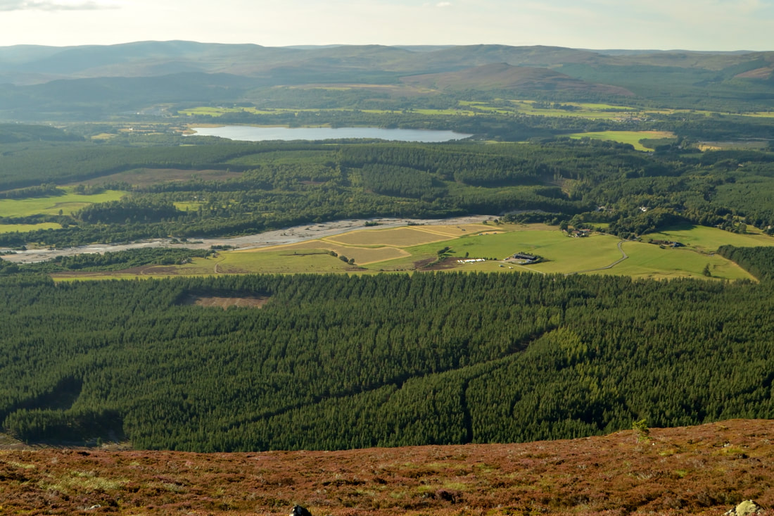 Although just 690M above sea level, the views from the summit of Cnicht are one of the best in Snowdonia. It is almost as if someone decided to create a viewpoint for the surrounding area. A fairly moderate walk passing facinating old slate quarries takes you to the foot of Cnicht. A direct route then takes you to the summit with a few exciting hands on scrambles along the way. From the airy and exposed summit there are breathtaking panoramic views of the neighbouring Moelwyns, the higher ranges of Snowdonia and out to sea Tremadog Bay. If you time it for sunset the views will be out of this world. The descent is a moderate walk passing the beautiful Llyn yr Adar and Llyn Lagi with views towards the Snowdon massif. Route DirectionsFrom the A498 road between the lakes of Llyn Dinas and Llyn Gwynant take the small road bridge over the river and follow this very tight track round the hill and you'll get to a sharp right angle turn, continue down the road past the buildings of Gerynt and Fedw Bach and eventually on the left side of the road you'll find a small car park. Walk a few hundred yards up the road away from the car park and you'll see the entrance to Gelli-Lago.
Follow the path through Gelli-Lago making sure to respect this part of the path as it passes through private land. Once round the back of Gelli-Lago the path starts to climb along side the stream up towards the valley. Follow the path right up through the valley until you can clearly see the walls of Cnicht in front of you. When you get to the end of the valley the path will turn right through Bwlch y Battel. Follow the path past the peat bog lake and you should now see the Porthmadog Bay in the very far distance. At Bwlch y Battel many are tempted to climb towards Cnicht too soon, instead carry on past the small peat bog lake and down slightly then a path will go left round. Just round the corner you will find a disused quarry and buildings which provide a great rest stop. The quarries in the welsh mountains stand like ghost towns and are a mystical reminder of the industrial past of the welsh mountains. From the quarry now head up east towards the foot of Cnicht and eventually you will meet the south western approaching path from Croeser. When you reach this path turn left onto it and the fun will begin as you tackle the final descent to Cnicht. The final descent of Cnicht is very exciting and the drop in the corner of your eye towards Moelwyn Mawr can be very distracting. The path becomes less and less obvious the nearer you get to the summit. On reaching the summit you will understand why so many people rave about the views off this surprisingly quiet yet majestic little mountain, known as the matter horn of Wales. After taking in the views from the summit the somewhat easier ascent of the back ridge of Cnicht is down the very visible path which passes firstly, the Llyn Biswall and secondly Llyn yr Adar. Llyn yr Adar is an amazing lake with an unbelievable view of Snowdon as its backdrop. Walk around Llyn yr Adar to its northern shore and then the path snakes between Craig Llyn-llagi and Cyrniau and then round to the right before turning left again and then down to Llyn Llagi. Follow the path from Llyn Llagi down past Carnedd Melyn and following the stream back down towards Llwynyrhwch, respecting once again the path through private land. Once at the small road again simply follow the road back down towards the car park. |
AuthorThe UK Walks are some of the best walks across the UK that any one can do with limited resources. You dont need to have specailist equipment or even be very fit. You must, however, want to be outside in the countryside. |
 RSS Feed
